What's under your feet: reading the rock map
Open this place in Erode Lab →
Two mountains in the same climate, rising at the same rate, can wear down at different speeds, because one is made of different rock from the other. A landscape model needs to know what the ground is made of. Erode Lab gets that from a geologic map, and you can see it in the app's Rock view.
Where the rock map comes from
Geologists have mapped the rocks at the surface almost everywhere, at scales from whole continents down to single valleys. Macrostrat, a project at the University of Wisconsin–Madison, brings thousands of those maps together into one database you can query by location (Peters et al. 2018). Ask it about a point and it returns the map units there at every scale it has: the rock's name, its age, and its lithologies (granite, sandstone, shale, limestone, glacial till and so on).
When you load a place, Erode Lab asks Macrostrat about a grid of 8 × 8 points across the map and turns each answer into numbers the model can use. Each point stands for a block an eighth of the map across. Where the most detailed map shows a thin loose deposit (a wash or a moraine) but a coarser map at the same point shows crystalline or volcanic bedrock underneath, the block takes the bedrock: the deposit is usually narrower or thinner than the block. Where there's no map at all, the model uses procedural rock instead.
What "erodibility" means
In the river law the model uses, the rate a river cuts down is its stream power times a number, the erodibility, that says how easily the bed gives way (see How rivers and glaciers carve valleys). Hard, massive rock with few cracks gives way slowly. Rock that is weak, thinly bedded or fractured gives way faster. Laboratory and field work tie this to rock strength and to the size of the sediment a river carries as tools (Sklar & Dietrich 2001).
Erodibility is the hardest number in landscape modelling to pin down. It can't be measured directly; it has to be inferred from how fast real landscapes wear down. The usual tool is cosmogenic beryllium-10, an isotope that builds up in quartz grains near the surface: the sand leaving a basin records how fast that basin has been eroding over the last few thousand years. Erode Lab's "Calibrated hardness" option fits the erodibility of crystalline rock to about 120 such basins in the San Gabriel Mountains of California, where roughly 70% of the measured rates fall within a factor of two of the model's. It's off by default, so the presets don't use it.
Why the Grand Canyon steps
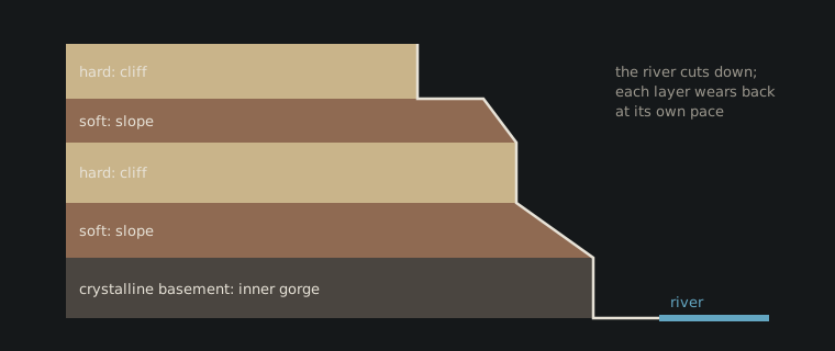
The walls of the Grand Canyon aren't smooth slopes. They climb in a staircase: a sheer cliff, then a sloping bench, then another cliff. Each step is a layer of rock. The canyon cuts through a stack of nearly flat sedimentary layers more than a kilometre thick, laid down over hundreds of millions of years on top of much older crystalline rock, with a gap of over a billion years between them in places: the Great Unconformity (Beus & Morales 2003).
- Cliff-formers are strong, massive layers: the Kaibab Limestone at the rim, the pale Coconino Sandstone, and the great Redwall Limestone cliff partway down.
- Slope-formers are weak or thinly bedded layers, such as the Hermit Shale and the Bright Angel Shale. They weather and crumble back into gentler slopes. The Bright Angel Shale's slope forms the wide Tonto Platform.
- At the bottom, the Colorado River has cut down into the Vishnu Schist and its granites, crystalline rock nearly two billion years old, which stands in the steep, narrow Inner Gorge.
As the river cuts down, each layer it exposes wears back at its own pace. Strong layers hold up vertical cliffs, and weak ones retreat into slopes and leave the cliff above them standing out.
What the model shows (and what it doesn't)
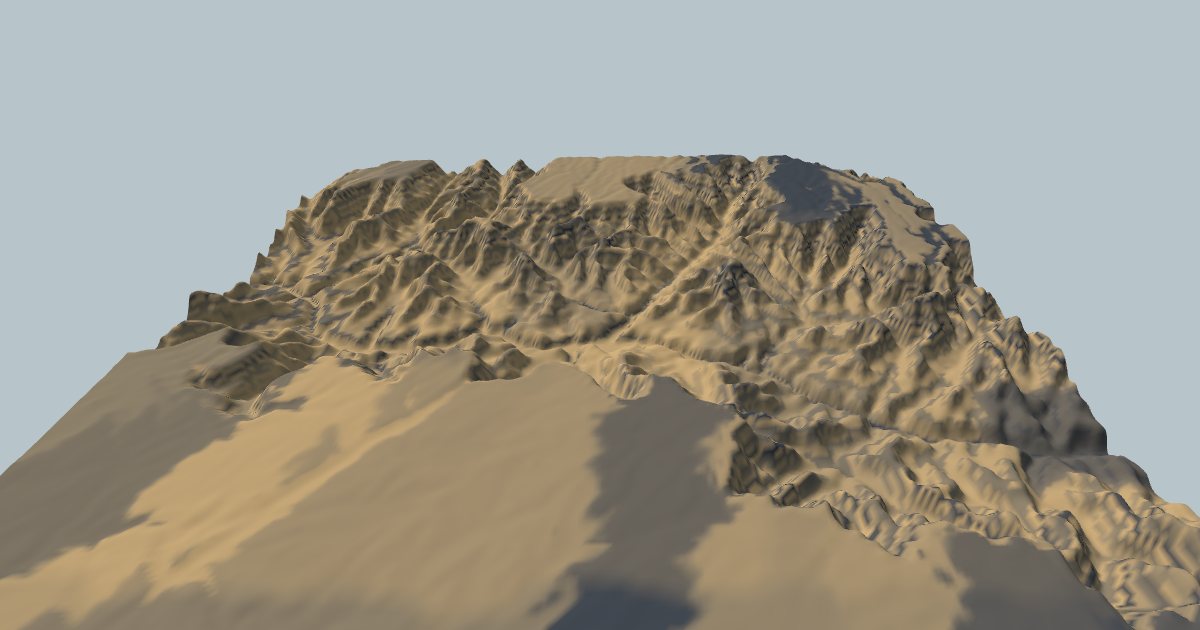
Open the Grand Canyon in Erode Lab and switch to the Rock view. Harder rock is shaded dark, softer rock tan and loose sediment yellow.
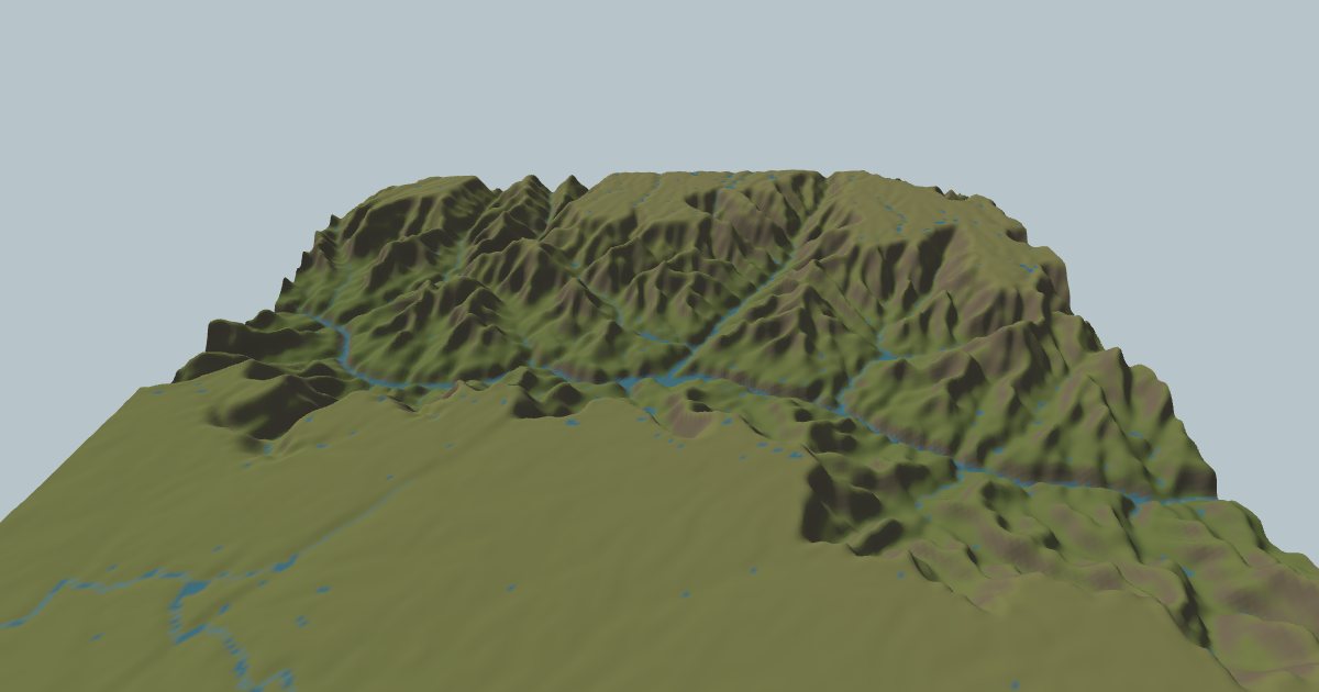
Be clear about what is real and what is generic here:
- The rock map is real but coarse. It comes from Macrostrat, sampled 8 × 8 across the map, so on a 40 km map each sample covers a block about 5 km wide. It sets how hard each part of the map is overall. It doesn't trace the individual layers in the canyon walls.
- The layers are generic. The model's Layering setting makes hard and soft beds, about 70 m thick, alternate with depth in sedimentary rock, with a gentle dip. They move up with uplift, so cliffs and benches form where rivers cut through them. These are not the real Kaibab, Coconino and Redwall in their real places; they show the mechanism, not the canyon's actual stratigraphy.
Run it forward and you should see the side canyons cut back into the plateau, and benches form where the generic layers change.
References
- Beus, S. S. & Morales, M. (eds.) (2003). Grand Canyon Geology, 2nd edition. Oxford University Press.
- Peters, S. E., Husson, J. M. & Czaplewski, J. (2018). Macrostrat: a platform for geological data integration and deep-time Earth crust research. Geochemistry, Geophysics, Geosystems 19, 1393–1409.
- Sklar, L. S. & Dietrich, W. E. (2001). Sediment and rock strength controls on river incision into bedrock. Geology 29, 1087–1090.
Geology: Macrostrat (CC BY 4.0). Terrain: Terrain Tiles on AWS. Full credits on the Credits page.