Why the Matterhorn is a horn
Open this place in Erode Lab →
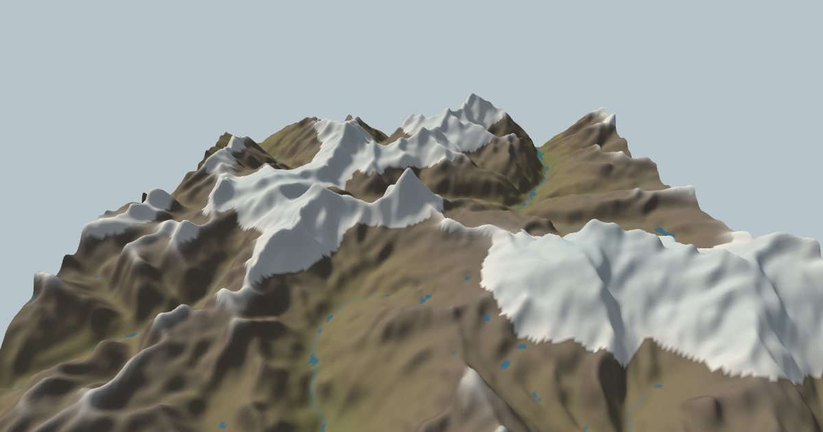
The Matterhorn looks like a child's drawing of a mountain: four steep faces meeting in a single point, 4,478 m above sea level on the Swiss–Italian border. Uplift made the mountain; ice sculpted its shape. It was carved, by ice cutting into the mountain from several sides at once.
Start with a cirque
High in the mountains, snow collects in hollows on the shady, sheltered side of a peak. Where more snow falls each winter than melts each summer, it compacts into ice and a small glacier forms. That happens above the snowline, the height where a year's snowfall and melt balance. It depends on the climate: summer warmth on one side and snowfall on the other (Ohmura et al. 1992).
A glacier in a hollow erodes the hollow. Ice rotating in it scours its floor, and freezing and thawing at the back wall loosen blocks that the ice carries away. The hollow deepens into an armchair shape with a steep headwall and a lip at the front: a cirque (Benn & Evans 2010). Because the headwall keeps failing, cirques grow backward into the mountain. In some ranges, cirque retreat rather than valley-floor erosion does much of the work of lowering the peaks (Oskin & Burbank 2005).
Two cirques make an arête, three or more make a horn
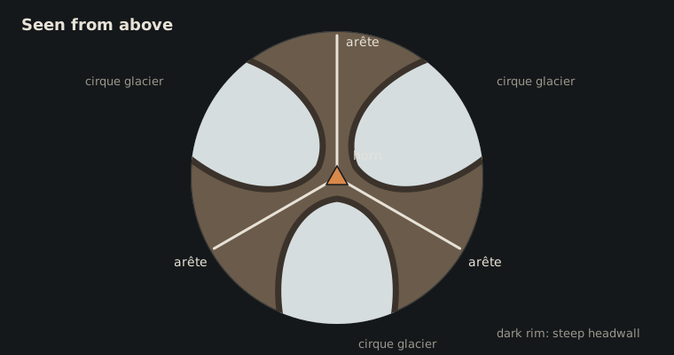
Now put cirques on several sides of one mountain. Each one eats back toward the summit. Where two cirques grow toward each other, the rock between them thins into a narrow, jagged ridge: an arête. Where three or more meet, what's left is a steep pyramid with flat faces and sharp edges: a horn. The Matterhorn's four faces are the back walls of the cirques around it, and its ridges (the Hörnli, Zmutt, Lion and Furggen) are the arêtes between them.
The rock helps. The Matterhorn's upper part is hard gneiss, part of a slab of crust (the Dent Blanche nappe) that was pushed over the rocks beneath during the Alpine collision. Hard rock can stand in steep faces that softer rock couldn't hold.
When ice controls the height of mountains
Glaciers don't just sculpt peaks; they can limit how high a range grows. Where rock is uplifted into the zone around the snowline, glaciers erode it fast enough to keep pace. Across whole ranges, average heights cluster near the snowline. This idea is called the "glacial buzzsaw" (Brozović et al. 1997; Mitchell & Montgomery 2006). Peaks like the Matterhorn stand above that level because their faces are too steep to hold much ice: the buzzsaw cuts around them, not through them.
What Erode Lab shows
Open the Matterhorn in Erode Lab. It loads today's terrain, the mapped rock and a snowline from the local climate. The model puts it at about 3,330 m; the real one is roughly 3,000–3,100 m (approximate). At that snowline the high basins and peaks around the summit start under ice.
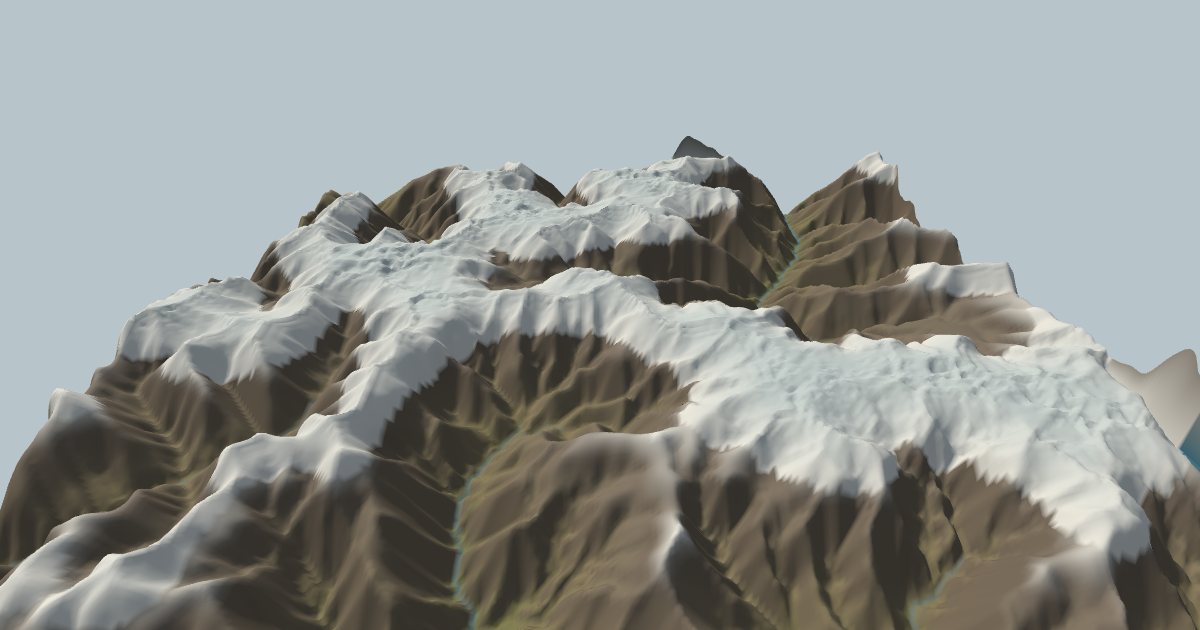
Run it forward at today's climate and the ice settles into the high basins and valley heads and spreads across the high ground, while rivers cut the lower valleys. The summit stays close to its real height because glacial erosion works around the steep peaks rather than over them. Turn on ice-age cycles and the snowline drops by up to 1,100 m at each glacial maximum. The ice grows into a cap over almost the whole map and then retreats to the high cirques in between, as it did in the real Alps.
The model's check against the last ice age is a good test of what it can and can't do. Solved on today's terrain with the snowline lowered, on a 27 km map, the model's ice covers 98% of the area that swisstopo's map of the last glacial maximum shows as ice (Schlüchter 2009), though it also puts some ice on peaks that stood above it (overlap 0.76). But its ice in the big valleys is far too thin: about 150–250 m at Zermatt, where the real glacier was about 1,300 m thick. In reality, the Rhône glacier dammed the valley with ice from the whole Valais. The model's map has no ice flowing in from outside, so its valley ice drains away instead.
Two other honest limits:
- Grid size. On a 20 km map the grid cells are about 80 m across, so knife-edge arêtes a few metres wide are blurred into broader ridges.
- Slope limit. The model lets slopes fail as landslides above a threshold angle, but never below the slope today's terrain already has. So the Matterhorn's real faces are kept, but the model doesn't sharpen a horn out of a rounded hill.
References
- Benn, D. I. & Evans, D. J. A. (2010). Glaciers and Glaciation, 2nd edition. Hodder Education.
- Brozović, N., Burbank, D. W. & Meigs, A. J. (1997). Climatic limits on landscape development in the northwestern Himalaya. Science 276, 571–574.
- Mitchell, S. G. & Montgomery, D. R. (2006). Influence of a glacial buzzsaw on the height and morphology of the Cascade Range in central Washington State, USA. Quaternary Research 65, 96–107.
- Ohmura, A., Kasser, P. & Funk, M. (1992). Climate at the equilibrium line of glaciers. Journal of Glaciology 38, 397–411.
- Oskin, M. & Burbank, D. W. (2005). Alpine landscape evolution dominated by cirque retreat. Geology 33, 933–936.
- Schlüchter, C. (2009). Die Schweiz während des letzteiszeitlichen Maximums (LGM), 1:500,000. Federal Office of Topography swisstopo.
Terrain in the images: Terrain Tiles on AWS. Rock: Macrostrat. Climate: ERA5. Full credits on the Credits page.