How rivers and glaciers carve valleys
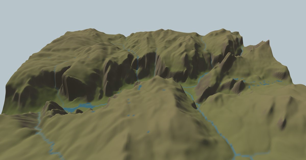
Open this place in Erode Lab →
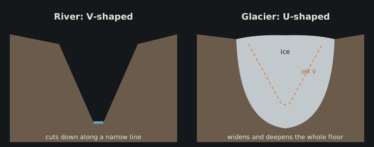
Stand at the end of Yosemite Valley and look up it. The walls rise almost straight from a flat floor nearly a mile wide. Now picture a canyon cut by a mountain river: steep slopes meeting in a narrow bottom, with barely room for the water. The first shape is a U and the second a V. They come from two very different tools. A river cuts along a line, while a glacier grinds away its whole bed.
The river: cutting along a line
A river erodes where it flows. It drags sand and gravel along its bed, plucks loose blocks and dissolves some rock. How fast it cuts down depends mostly on two things: how much water it carries and how steep its bed is. Geomorphologists describe this with the stream-power law: the rate of incision is proportional to the drainage area upstream (a stand-in for discharge) raised to a power, times the channel slope, times a number for how easily the rock erodes (Howard & Kerby 1983; Whipple & Tucker 1999).
Two things follow from that simple rule:
- Rivers cut fastest where they are big and steep. So they eat back into mountain fronts, and a steep step in a river (a knickpoint) migrates upstream over time.
- The cutting happens along one narrow line, the channel. The slopes on either side don't cut themselves; they collapse, creep and slide down toward the river as it deepens. They settle at the steepest angle the rock and soil can hold. The result is a valley with straight sides meeting at the bottom: a V.
The glacier: grinding the whole floor
A glacier is a river of ice, but it behaves nothing like water. Ice deforms slowly under its own weight (Glen 1955), so a valley glacier is typically tens to hundreds of metres thick and fills its valley from wall to wall. Where its base is at the melting point, it slides over the bed. Rocks frozen into the base scrape the bedrock like sandpaper (abrasion), and the ice pulls away loosened blocks (quarrying).
The key is where that happens. Erosion under a glacier scales with how fast the ice slides, and the ice slides fastest under the thick, central part of the glacier, not at a single point. A numerical model by Harbor, Hallet and Raymond (1988) showed that if erosion follows sliding speed, a V-shaped river valley filled by a glacier evolves into a parabolic, U-shaped trough. The floor deepens and widens and the walls steepen, until the shape matches the flow.
Glaciers also leave other marks that rivers can't:
- Hanging valleys. A small tributary glacier can't deepen its valley as fast as the main one, so when the ice melts its floor is left high above the main valley. Yosemite's Bridalveil Fall pours out of one (Matthes 1930).
- Overdeepenings. A glacier can scour its bed below the level of its own outlet, because ice can flow uphill under pressure. Water can't, so when the ice leaves, those basins fill with lakes, or with the sea.
Yosemite: a U carved into granite
Yosemite Valley began as a river canyon cut by the Merced River into the granite of the Sierra Nevada. Repeated glaciations over the last million years or more filled it with ice, which widened and deepened it into the trough you see today (Matthes 1930). The flat floor is younger still: sediment that filled the deepened basin after the last ice melted.
In Erode Lab, the Yosemite preset loads today's real terrain and the mapped granite. Run it forward and the model's rivers and glaciers start from that shape. Under today's climate the snowline sits well above the valley, so the change you see on the floor is river work and sediment filling. Turn on ice-age cycles to bring the glaciers back down into it.
Milford Sound: a U the sea has filled
Fiordland in New Zealand shows the same shape drowned. Milford Sound (really a fjord) is a glacial trough whose floor was carved below sea level. When the ice retreated, the sea flowed in. Its walls rise straight out of the water, and the Sound's mouth is shallower than its middle: the overdeepening described above.
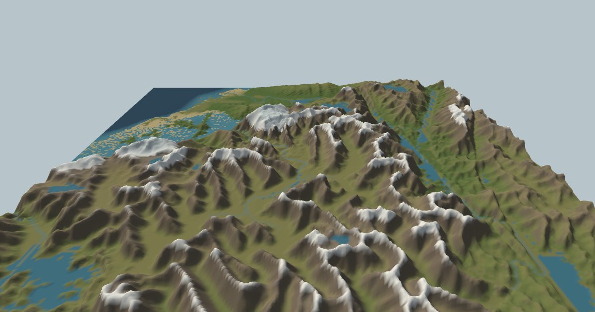
The snowline there is low (about 1,600–1,800 m, and the model's comes out at a similar height), so glaciers grow on the high ground even under today's climate. Run it and you should see the ice gather in the heads of valleys, which it scoops out, while the rivers below carry the debris down to the sea.
How the model does it
Erode Lab solves both processes on the same grid, every time step:
- Rivers follow the stream-power law, solved with an implicit method that stays stable over long time steps (Braun & Willett 2013). Rivers start only where enough water collects (a channel head). Above that, slopes creep and fail as landslides when they get too steep.
- Glaciers are a shallow-ice model: ice flows down its own surface slope by deformation (Glen's law) and sliding, gains snow above the snowline and melts below it. The bed erodes in proportion to the sliding speed, which is what turns V-shapes into U-shapes.
It's a simplification: a few hundred to a thousand cells across, with one ice model and one river law. It reproduces the broad shapes, not every waterfall. See About for what it does and doesn't capture.
References
- Braun, J. & Willett, S. D. (2013). A very efficient O(n), implicit and parallel method to solve the stream power equation governing fluvial incision and landscape evolution. Geomorphology 180–181, 170–179.
- Glen, J. W. (1955). The creep of polycrystalline ice. Proceedings of the Royal Society A 228, 519–538.
- Harbor, J. M., Hallet, B. & Raymond, C. F. (1988). A numerical model of landform development by glacial erosion. Nature 333, 347–349.
- Howard, A. D. & Kerby, G. (1983). Channel changes in badlands. Geological Society of America Bulletin 94, 739–752.
- Matthes, F. E. (1930). Geologic History of the Yosemite Valley. U.S. Geological Survey Professional Paper 160.
- Whipple, K. X. & Tucker, G. E. (1999). Dynamics of the stream-power river incision model. Journal of Geophysical Research 104(B8), 17661–17674.
Terrain in the images: Terrain Tiles on AWS. Rock: Macrostrat. Climate: ERA5. Full credits on the Credits page.